CM2 Acquisition and Imaging
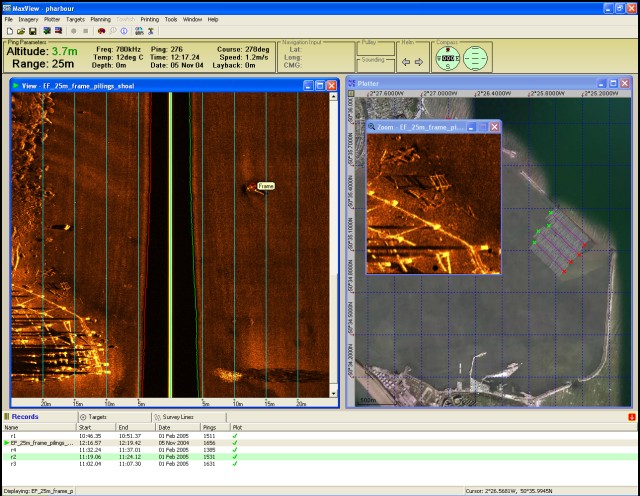
MaxView, the acquisition package for the CM2 system that runs under Windows on any PC-compatible platform provides all acquisition, track plotting, display, editing and conversion functions from a familiar Windows interface.

Features and benefits:
- Flexible navigation interface accepts Lat/Long and UTM data
- Comprehensive plotter shows vessel position, targets and swept coverage
- Chart imagery can be user-created from paper or electronic sources. Perfect for inland work where no commercial chart is available
- MaxView can be installed license free on multiple PCs. Only data acquisition is Dongle protected
- Display and recording of optional towfish heading and depth sensors
- Multiple replay windows allow easy record comparison
- Geo-referenced targets can be marked during acquisition or post processing
- Easy export of imagery, target and navigation data into other software packages
A detailed list of features can be downloaded from the below here
MaxView is now available to download for free. This version requires a dongle to save data onto the survey computer. Without a dongle present, all other MaxView functions are available.
C-MAX staff have also been working closely with the industry's leading acquisition software providers to enable the CM2 Sonar Transceiver to work with software from the following manufacturers:
- Chesapeake Technologies
- Hypack
- Info Express
- IXSEA
- Oceanic Imaging Consultants (OIC)
- QPS
- Triton Imaging
